Hiking Route: Fanø Dunes Plantation
The hiking route on Fanø is a combination of 2 existing routes created by the Danish Nature Agency. The two routes are located on opposite sides of the road that connects the two villages Nordby and Sønderho. The area is part of the Wadden Sea National Park.
The route is in a figure of eight pattern, and there are several different potential starting points for the trip. The selected starting point here is "cyclist rest stop" on the corner of Postvjen [sic: Postvejen]/Mågekolonivej, where there are a number of facilities such as maps of the area, a covered picnic area, and hammocks. Alternative starting points are the parking area leading to Sønderho Gamle Fuglekøje (an old duck decoy), or from Skovlegepladsen (the forest playground), where you can find map material, toilet and picnic area.
The following description has its starting point from the rest stop on the Postvejen/Mågekolonivej corner.
Route description
From the starting point at the rest stop at the Postvejen/Mågekolonivej intersection, one continues along Mågekolonivej to the parking area 0.4 km to the west. Mågekolonivej was built during World War II as a supply route to the defence facilities constructed along the beach. Today, the Concrete Road is the access road to the Forest Playground.
From the parking area continue along the gravel path 0.6 km to Pælebjerg, the highest point of the island. Here there is a beautiful view of the plantation and the beach to the west.
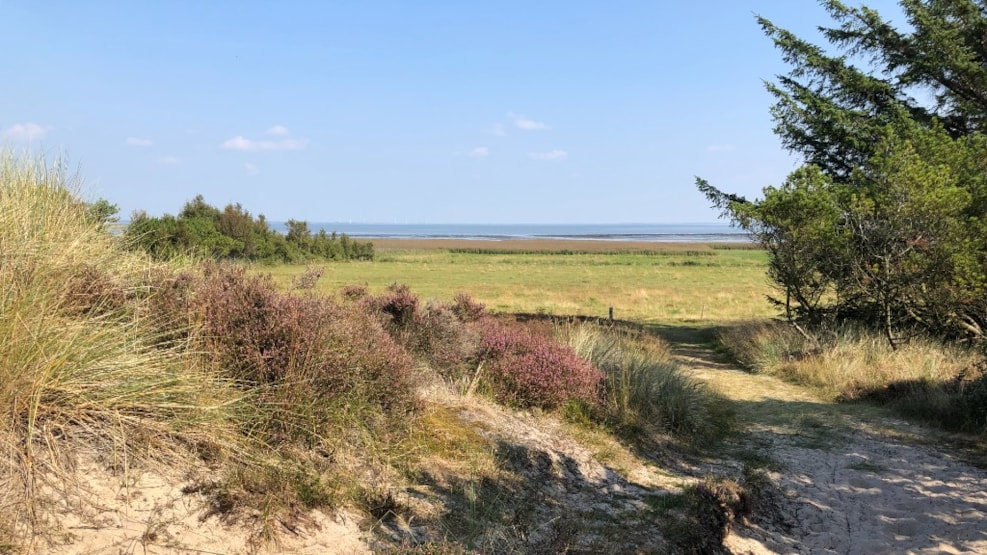
From Pælebjerg follow the yellow route that leads through the western part of the plantation to an open dune area with dunes, meadows and small water holes, a typical landscape for the western part of Fanø. The path here is a walking trail. Follow the yellow route 2.4 km until it ends at Skovlegepladsen parking area.
Skovlegepladsen (the Forest Playground) is a combined nature playground, wood sculpture park and picnic area with toilets. Continue along the gravel path from Skovlegepladsen's parking area 0.9 km until the path ends at the cycle path between Nordby and Sønderho. Keep right along the cycle path about 10 metres until the marked route swings to the right into the forest. Here you will walk on a track for about 600 metres on the yellow route until it again meets the cycle path. Then continue to the right on the cycle path. After 200 metres cross the main road.
Continue on the yellow route 2.5 km to Sønderho Gamle Fuglekøje. You will first walk on a farm track eastwards, where you will have a view of the Wadden Sea after about 1 km. Then to the north-east through both scrubland and dune heathland with heather and forest. After 1.6 km on a walking trail that twists with the landscape, turn left on a farm track that leads through the forest to Sønderho Gamle Fuglekøje.
Sønderho Gamle Fuglekøje was built in the 1800s with the aim of catching ducks during migration. Ducks were captured until 1934, when this form of hunting was banned. Sønderho Gamle Fuglekøje now serves as an open-air museum with information boards and the duck decoy, along with the birdlife you can experience in the area. There is also a bird watching platform overlooking the Wadden Sea.
From Sønderho Fuglekøje walk 1.8 km to the north on the yellow route to Annedalsbjerg. The first section is a broad hiking trail, after which one goes through a gate and continues on a hiking trail in an open dune heathland overlooking the Wadden Sea. The last section runs along a farm track on the outskirts of Fanø Dune Plantation.
Annedalsbjerg is one of the oldest dune areas on Fanø and from the top of the dunes there are views of the dunes plantation, the marshland to the north and the mainland on the other side around Esbjerg. Here one also finds the second of the two duck decoys that can still be seen and visited, Albue Fuglekøje.
From Annedalsbjerg continue 1.4 km southwest on the yellow route. Here one travels through some of the oldest of Fanø Klitplantage and then through open dune heathland until the yellow route ends back at the parking lot by the main road.
Cross the main road and hike on the bike path to the north 1.2 km back to the starting point at the cyclist stop at Postvejen/Mågekolonivej.
Total length: 12.05 km
Distance on asphalt: 1.2 km on bike/hiking trail
0.2 km on bike/hiking trail
0.4 km on concrete roadway, built during World War II for defence installations
Percent asphalt excluding concrete roadway: 11.62 %
Percent asphalt including concrete roadway: 14.94 %
Traffic hazard areas:
Main road must be crossed twice, otherwise none
Proximity to main thoroughfare
0.6 km through forest about 50-100 metres from the road
User-friendly signage
Consists of two complete marked yellow routes.
Variation
You walk through the typical Fanø landscapes, plantation, open new dune heathland, old dune heathland and the route alternates between the types of landscape several times
Intensive land use
None, the entire route lies within a protected natural area without settlement.